Superbloom Comparison Map
Background and Methods:
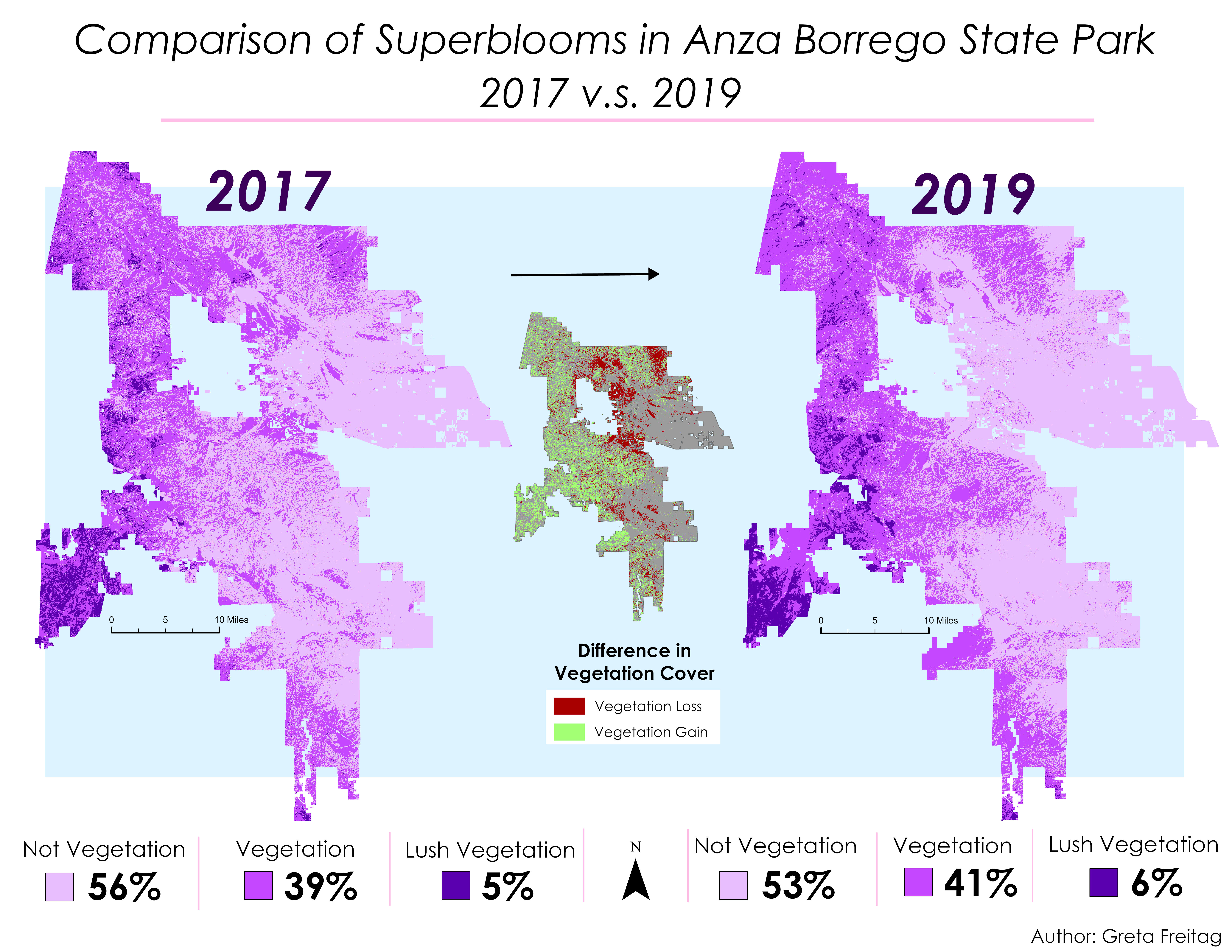
To use newly acquired remote sensing skills, I wanted to compare the superblooms in San Diego's Anza Borrego Desert State Park using satellite imagery and classification techniques.
Using Earth Explorer, I downloaded Landsat 8 tracts in the correct area for the 2017 and 2019 superbloom seasons. Then after clipping to the perimeter of the park, I went through the long process of classifying vegetation and non-vegetation using unsupervised classification methods. I included regular vegetation and lush vegetation, because some areas were clearly more or less vibrant between each year.
The result is the map on the left, which shows that 2019 had a slightly more lush bloom season, though 2017 covered many areas that 2019 did not. This can be seen in the difference map in the center.